


Core Values
- Open, transform, and position NCZ and CAD files
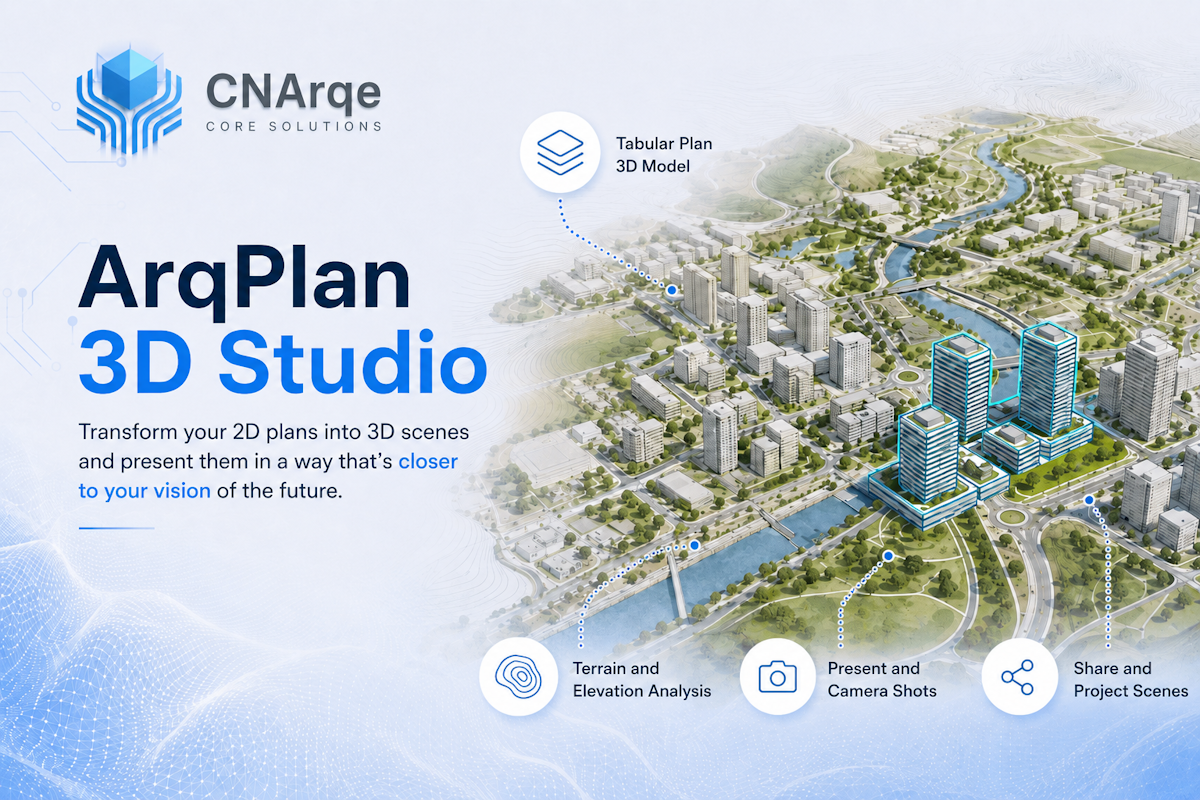
- Create 3D scenes from plans, terrain, and development data
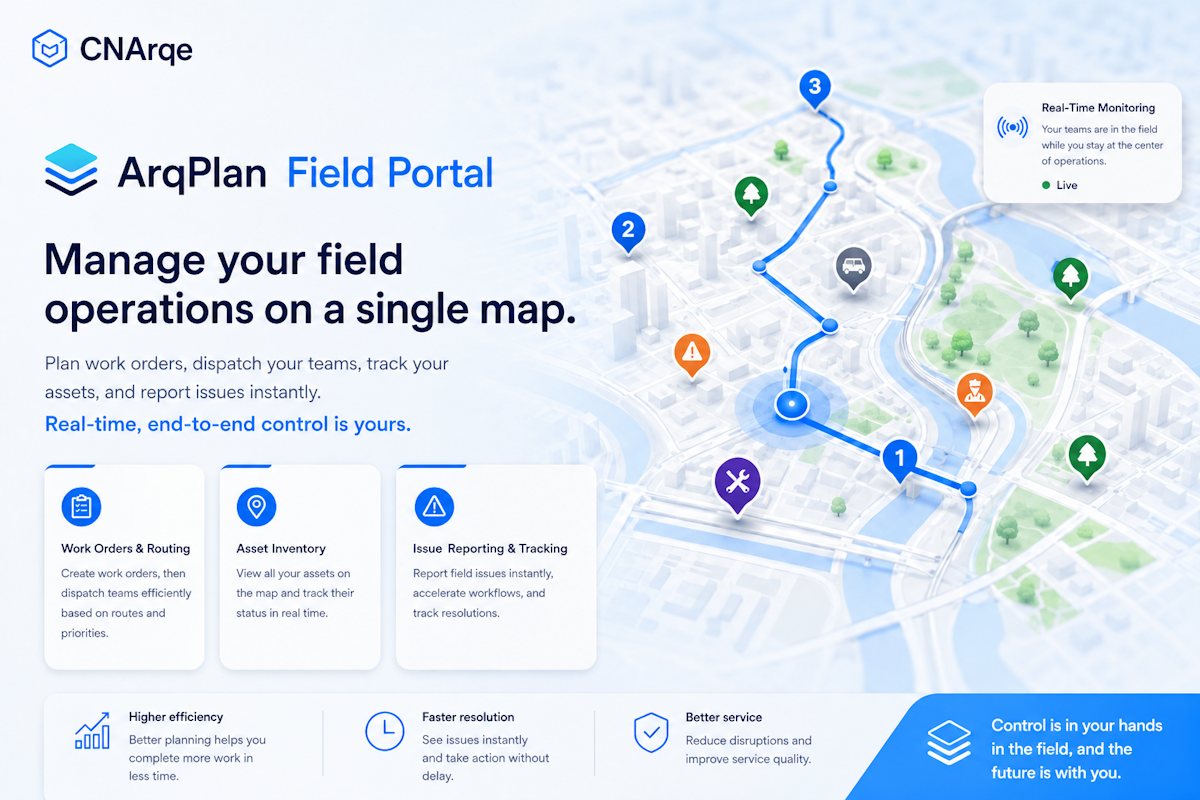
- Manage field teams, work orders, and assets from the map
The ArqPlan product family combines NCZ, CAD, and GIS data management, plan-based 3D visualization, and location-based field operations in one product ecosystem.
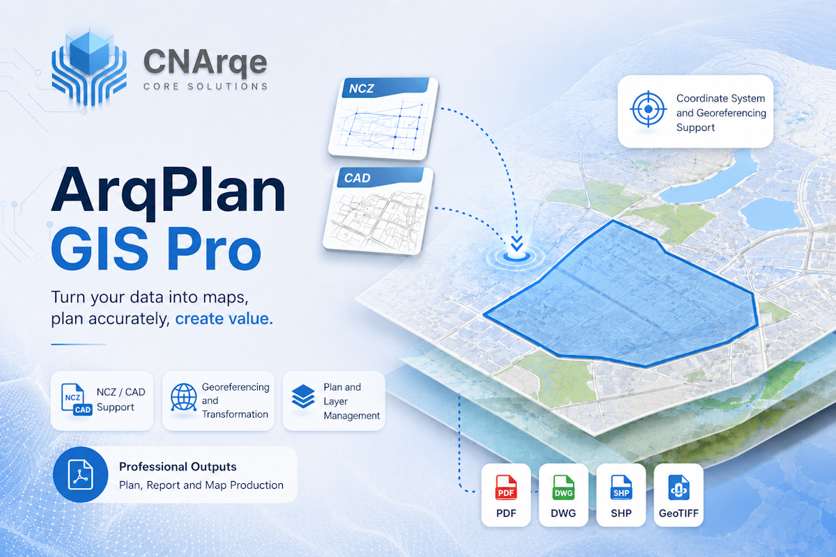
ArqPlan GIS Pro — Open, position, transform, and manage NCZ, CAD, and GIS data.
ArqPlan 3D Studio — Transform plans, terrain, and architectural data into compelling 3D scenes.
ArqPlan Field Portal — Manage field teams, work orders, reports, and assets from one map.
Spatial data prepared in ArqPlan GIS Pro can be visualized in ArqPlan 3D Studio and used in field operations through ArqPlan Field Portal.