CNArqeCNArqe
HomeSolutionsConsultingReferencesAboutContact

Turn Your Plans into 3D Projects

Combine plans, terrain, development, and architectural data in a single scene; create plan-based mass models, camera routes, virtual tours, and shareable web presentations.

Value Proposition

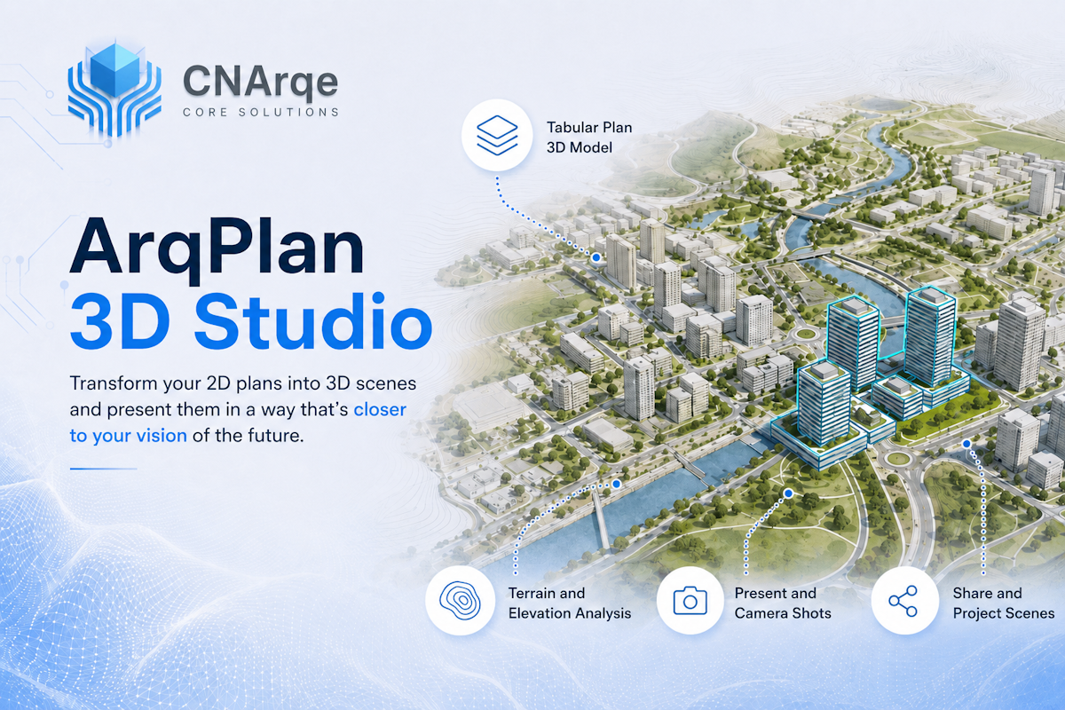
    See how zoning and planning decisions will look on site before implementation. Bring together terrain, building mass, landscape, and architectural models in a compelling presentation environment.

    Who Is It For

      • Architecture firms
      • Urban planning offices
      • Landscape architects
      • Construction companies
      • Real estate developers
      • Municipalities
      • Project and investment presentation teams

      Key Features

        • 3D terrain visualization
        • Plan-based building mass modeling
        • Generate models by number of floors
        • TAKS, KAKS, and floor area ratio scenarios
        • Setback distance display
        • Import architectural models
        • Landscape and tree placement
        • Urban furniture
        • Sun and shadow simulation
        • Camera routes
        • Presentation frames
        • Virtual tours
        • Share scenes on the web
        • Model and scenario comparison

        Use Cases

          • Generate building mass from zoning plans
          • Present architectural models with parcel context
          • Prepare real estate investment presentations
          • Show landscape design before implementation
          • Compare alternative development scenarios
          • Create project walkthroughs with camera routes

          Planned Data and Model Support

            • GIS layers
            • Terrain and elevation data
            • glTF / GLB
            • OBJ
            • IFC
            • 3D Tiles
            • Other architectural formats based on pipeline requirements

            Pricing

              Quoted according to scene scope, model count, data volume, presentation features, and user count.

              Frequently Asked Questions

                • Can 2D plans be automatically converted to 3D?
                • Can architectural models be added to the system?
                • Can sun and shadow analysis be performed?
                • Can the scene be shared with clients?
                • Can virtual tours be created?
                • Can terrain and landscape be shown together?