CNArqeCNArqe
HomeSolutionsConsultingReferencesAboutContact

Bring NCZ and CAD Data to Your Map

Open NCZ and CAD files, manage coordinate systems, position unprojected data using control points, and transform your plans into web-based GIS layers.

Value Proposition

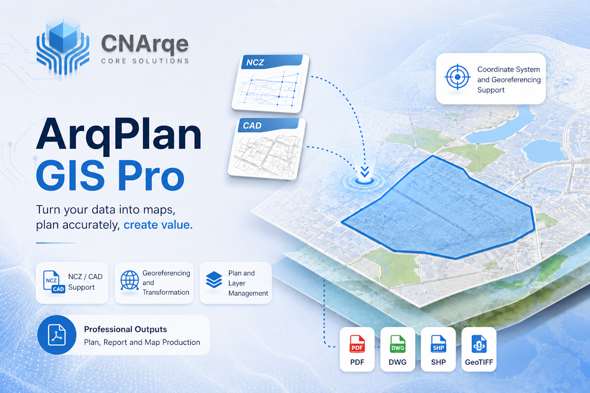
    Bring technical data with known projection or local coordinate planes onto the map through a controlled workflow. View, validate, transform, query, and produce professional outputs.

    Who Is It For

      • Urban planners
      • Surveying engineers
      • Cadastre and planning offices
      • Architecture firms
      • Real estate developers
      • Municipalities
      • Infrastructure organizations

      Key Features

        • View NCZ files
        • Import CAD files
        • GIS layer management
        • Assign coordinate reference systems
        • Suggested CRS detection
        • Local coordinate plane management
        • Georeferencing with control points
        • RMS error and accuracy check
        • Parcel and block queries
        • Map legend and symbology
        • Measurement, filtering, and analysis
        • Professional map output
        • Data export
        • User, project, and permission management

        Coordinate Reference System States

          • CRS defined
          • Possible CRS detected
          • Local coordinate plane
          • Positioning required
          • Undetermined

          Use Cases

            • View NCZ plan files on the web
            • Place unprojected CAD data on the map
            • Local coordinate transformation using control points
            • Manage plans and parcel data together
            • Build an enterprise plan portal
            • Generate map and plan outputs

            Planned Data Support

              • NCZ
              • DWG
              • DXF
              • SHP
              • GeoJSON
              • KML
              • GeoPackage
              • CSV coordinate data

              Pricing

                Quoted according to organization size, user count, data volume, modules, and integration scope.

                Frequently Asked Questions

                  • Can unprojected CAD files be used?
                  • What if the NCZ file has no CRS?
                  • Does the system suggest an EPSG automatically?
                  • How are local coordinates moved to the map?
                  • Can it be deployed on-premise?
                  • Which output formats are supported?